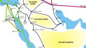
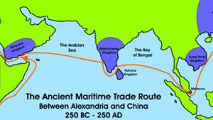
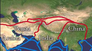
In his translation of the Xiyu juan, or “Chapter on the Western Regions” from the Hou Han shu, John Hill proposes in his notes (nos. 12.21 and 12.24) that a trade route used to exist between Petra and Wadi Sirhan to the east. Such a trade route would cross the desert to link Petra directly with Jauf, and subsequently to the trade routes that ran east from there to Gerrha or to the ports at the head of the Persian Gulf. This proposed trade route would have provided a direct link between Gerrha and the more northern ports such as Charax Spasinu on the Persian Gulf, and Gaza and Rhinocorura (modern al-‘Arish) on the Mediterranean Sea.
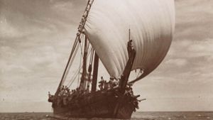
Hill’s reason for proposing this new trade route is based on his interpretation of an ancient Chinese manuscript. Throughout Chinese history, Chinese explorers, ambassadors, and merchants made occasional trips to the western world. Many of their reports were written down, and preserved.
The Chinese text that John Hill is referring to is one known as the Wei lue (or ‘Short Account of the Wei Dynasty’) composed by Yu Huan between 239 and 265 CE. It provides much additional material on Parthia and Da Qin or the Roman Empire than was included in the earlier account of these regions in the *Hou Han s*hu which were based on the reports of the Chinese envoy Gan Ying who reached the Persian Gulf in 97 CE and presented in an address to the Chinese Emperor circa 125 CE. The new material in the Wei lue appears to date from the late 2nd or early 3rd century CE and seems to be based on accounts from Arab, perhaps Nabataean, sources.
According to John Hill, the ancient Chinese text claims that “from Qielan (Wadi Sirhan) you again travel due west 600 li (250 km) to the kingdom of Sifu (Petra). “ Hill is currently working on a revised edition of his annotated translation of the Chapter on the Western Regions from the Hou Han shu, which should be available in a few months. He also hopes to make available a draft edition of his annotated translation of the Wei lue later this year on the Internet.
The basic units of measurement employed in the Hou Han shu, the li and the chi, have varied considerably through the ages and, at times, from district to district. Fortunately, however, they remained stable over the Qin and Han periods and a bronze standard measure, dated 9 AD, has been preserved at the Imperial Palace in Beijing. This has allowed accurate conversions to modern measurements, and the li is calculated to be 415.8 meters in length. Other ancient measurements were the Greek stadium (201.5 meters), the Roman stadium (185 meters), and the Roman mile (1,482 meters.)
There are several problems with the trade route that John Hill has suggested. First, this route does not appear on any maps of ancient trade routes in the Arabian Desert. Such a route would cross a wide desert expanse between Jafr in Jordan and Wadi Sirhan in Saudi Arabia. Secondly, the Chinese text suggests that there was a wang or ‘king’ of Wadi Sirhan, and as far as we know, Wadi Sirhan has never been a kingdom.
Wadi Sirhan
Wadi Sirhan is the name of a wadi (valley) that runs southeast from the ancient site of Al-Azrak in eastern Jordan that eventually crosses the border into Saudi Arabia and ends at the wells of Maybuu. It is about 140 kn/187 miles in length, and 5-18 kilometers (13-11) miles wide. (Encyclopedia of Islam). Musil called it a ‘sandy, marshy lowland, surrounded by low hillocks.’ King Esarhaddon (699-680 BC) undertook a campaign against the Bazu and the Khazu (the Buz and Hazo of the Bible, Genesis 22:21-2, Job 32:2, and Jeremiah 25:13,) who were living along Wadi Sirhan. In 634 AD the area was conquered by the Muslim armies after the battle of Yarmuk and the area became the much contested frontier between the Beni ‘lKayn and the Beni Kalb sub-tribes of the Kadu’a. (Bedouin tribes) Today the Beni Ruwala tribe inhabits it. However, Nabataea.net researchers couldn’t find any history between these two dates. In 1926 the local sheik signed the Treaty of Hadda, and the area became part of the Kingdom of Saudi Arabia.
As far as we could tell, any reference to a “king” of this area by the Chinese explorer must have referred to a local sheik. Hill explains it this way: “The Chinese word, “wang”, usually translated as “king,” is employed for everyone ranging from tribal chiefs to emperors - so there is no difficulty assuming it is used here for “sheik.” After the Roman takeover of Nabataea, (106 AD) Roman Forces used to patrol Wadi Sirhan. (Bowersock, Roman Arabia, pp. 155-159, 178; Millar, The Roman Near East pp. 138, 185).
Trade Routes
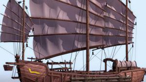
From our experience, trade routes can be funny things. Most westerners think in terms of major nations trading with other major nations through established and well-known routes. The eastern mindset is different. The Bedouin think in terms of being middlemen, conducting trade between two centers. This is significantly different. Camel caravans were making profit by bringing goods from one place to another, but they were not the official representatives of either center. The governments of these centers made money by taxing the caravans. The caravan owners made better profits when they avoided taxes. So trade routes were in constant flux as the caravans tried to avoid taxation centers. There were, and are, many ways to cross the desert. Each route has its positive and negative points.
First, any caravan passing through a settled area would have to pay something to the sheik who controlled that area. Settled areas, however, were usually located around water spots, and caravans needed water. The Nabataeans grew in wealth and power, because they developed secret water collection systems in the desert, so that their caravans did not need to pass through areas where they might be taxed.
Second, as civilizations developed and expanded, they started to build forts and taxation centers at various places where caravans might pass. Thus a cat and mouse game developed between caravan owners and those with the power to tax caravans passing through their region.
This constant flux makes it difficult for historians to accurately plot ancient trade routes. While major routes did occur, other routes that bypassed certain centers were used whenever it was profitable.
A New Trade Route
As mentioned above, based on Chinese records, John Hill has suggested that a trade route existed between Petra in the west and Gerrha in the East. The part of the route that ran east from Petra to Ail, and then to Ma’an and finally to Jafr is quite acceptable, and follows a natural course of travel between these centers. There is also enough water along this route for major camel caravans to pass. The problem with the suggested route was getting a caravan from Jafr to a spot with water in Wadi Sirhan. Since camels require about 80 - 100 liters of water each, a small caravan of 100 camels would require 8000 - 10,000 liters of water. There had to be a watering point between Jafr and Wadi Sirhan with a minimum of 10,000 liters and, preferably, much more.
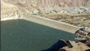
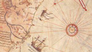
A well would not usually provide this kind of water, unless it was located in an area with close surface water. Such an area would have been an oasis, such as was found in Ma’an. If the caravans were to water in the desert, the watering spot would need to use a water collection system that fed into a large cistern. It became obvious that if we wanted to confirm the existence of a trade route along this path, we needed to locate a major source of water about half way between Jafr and Wadi Sirhan. We began our search by visiting the Jordanian village of Abu Lissan where the Dirawsha Bedouin tribe lives. They originally herded camels south of the Jafr area, before being settled by the Jordanian government around the well at Abu Lissan. After much discussion and thought, the old men of the village told us about a large ancient water cistern located in the desert east of Jafr. However, this is an area that is very hard to get to, so we couldn’t just drive on out to look for it. Then a few days later, while digging around in the basement of ACOR (American Center for Oriental Research) in Amman, we came across a map that actually showed the location of this large cistern. (Transcribed onto a map below)
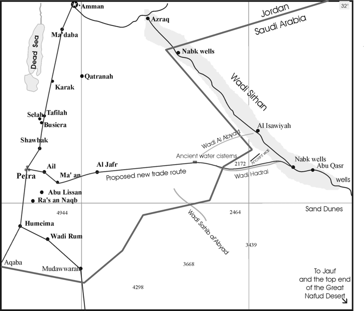
From the map above you can see that the water source is located almost exactly half way between Jafr and Al Isawiyah in Wadi Sirhan. So, it is very possible that there was a caravan route that went directly from Petra to Wadi Sirhan, and then south to Jauf. Imagine finding it via China!
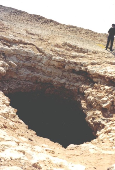
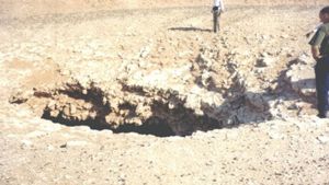
Recently a Nabataea.net reader Antonia Willis kindly sent us pictures of a huge sink hole in the area where the “Roman Pools” or “Ancient cistern” is marked on old maps. The pictures are below.
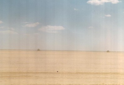
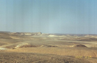
The Jafr Depression is a huge, low, flat desert. Near the far side (east) of the depression are a number of low hills as the land rises.
In these hills, long ago someone created a water collection system that fed a huge underground cistern. The old water collection system has since disappeared, but the huge cistern remains until this day as a witness to the water engineering genius of its builders.
In these hills, long ago someone created a water collection system that fed a huge underground cistern. The old water collection system has since disappeared, but the huge cistern remains until this day as a witness to the water engineering genius of its builders.

Page Discussion
Membership is required to comment. Membership is free of charge and available to everyone over the age of 16. Just click SignUp, or make a comment below. You will need a user name and a password. The system will automatically send a code to your email address. It should arrive in a few minutes. Enter the code, and you are finished.
Members who post adverts or use inappropriate language or make disrespectful comments will have their membership removed and be barred from the site. By becoming a member you agree to our Terms of Use and our Privacy, Cookies & Ad Policies. Remember that we will never, under any circumstances, sell or give your email address or private information to anyone unless required by law. Please keep your comments on topic. Thanks!